Pioneer

Ongoing
Connectivity


The European Space Agency (ESA)’s Pioneer partnership project marks a modern leap in how Europe supports innovation in space-based services

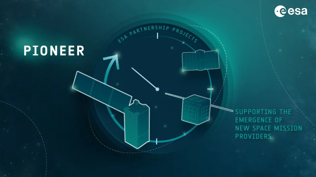
It provides a framework for in-orbit demonstration of commercial and institutional satellite technologies, helping start-ups and emerging space-mission providers validate their services in orbit.

The need for validation in orbit

Innovative space-based services, whether Earth observation, high-throughput communications, orbiting data analytics or platform hosting, face a major barrier: the cost and complexity of securing an in-orbit flight demonstration. Without flight heritage, many service providers struggle to convince customers, investors or operators of their capability.

ESA recognised this gap and launched Pioneer under its Advanced Research in Telecommunications Systems (ARTES) Partnership Projects programme to lower the barrier for new space mission providers by offering a structured pathway:

Custom Icon
ESA helps fund and guide the first one or two missions for a provider, reducing risk.
Custom Icon
The provider then continues independently into commercial operation once flight heritage is established.
Custom Icon
Pioneer offers quick and effective in-orbit validation of technology, enabling access to market for new space-based services.

The Pioneer programme aims to provide affordable and timely access to orbit for new-space providers and services; encourage commercialisation of technologies; enable demonstration of disruptive satellite services (for example: In-Orbit Demonstration and Validation (IOD/IOV), Internet of Things (IoT), aviation and maritime messaging, multi-function constellations, space domain awareness and intelligence); and reinforce Europe’s industrial competitiveness in new-space era by supporting Small and Medium-sized Enterprises (SMEs) and rapid-cycle missions.

How to work with Pioneer

Custom Icon
A company (or consortium) registers as a Space Mission Provider (SMP) under Pioneer, committing to develop an infrastructure capable of delivering in-orbit demonstration services.
Custom Icon
ESA provides support (financial, technical, risk-sharing) for the first in-orbit demonstration(s), often a small satellite or hosted payload mission.
Custom Icon
After demonstration, the SMP aims to operate commercially, offering service to other clients.
Custom Icon
The concept is open to European and Canadian industry.

Demonstrations

Sapion

Internet of Things (IoT) service

Open Cosmos | United Kingdom


Striving

IOV services

Sitael | Italy


IODA

Telecomms and Earth observation services

Airbus | France


SAAS

Aviation, maritime and data services

Spire Global | United Kingdom


Faraday 2G

IOV services

In space Missions | United Kingdom


xSPANCION

Telecomms and Earth observation services

AAC Clyde Space | United Kingdom


CORVUS

Space domain awareness demonstration

Spacemanic | Czechia


ESpaDA

Space domain awareness and intelligence services

Methera Global Communications Ltd | United Kingdom


Titan Forge

Mission simulation and operations facilities

Axient Systems | The Netherlands


STARS

Nanosat data relay services

Exobotics | United Kingdom


Infrastructure upgrades

A mission using the Airbus Arrow 150 platform was supported by Pioneer.


RELATED LINKS & CONTACTS

Triton-X

Ongoing
Connectivity

The European Space Agency (ESA) and industry partner LuxSpace, a subsidiary of OHB Group, are collaborating on a new generation of microsatellite platforms called Triton-X

Triton-x project key visual

Tailored for low Earth orbit (LEO) missions and designed with a New Space ethos, Triton-X is a modular, multi-mission product line aimed at commercial and institutional users who require fast, cost-effective access to orbit.


As the satellite market evolves, the demand for smaller, quicker-to-deploy spacecraft has grown strongly. Traditional platforms built for bespoke missions are costly and slow to manufacture. In answer to the problem, ESA instituted Triton-X under its Advanced Research in Telecommunications Systems (ARTES) Partnership Project programme to deliver a generic microsatellite platform optimised for fast time-to-market, lower recurring cost, and flexibility across applications, including telecommunications, Earth observation, technology demonstrations and situational awareness.


Triton-X provides European industry with a competitive product line that supports rideshare launches, accommodates multiple payload types, and opens up access to orbit for new players and constellations.


Platform variants and key specifications


Triton-X is designed as a product family with three size classes to accommodate different mission scales.

VariantLaunch MassPayload MassPayload Power
Light45 kg12.5 kg15 W
Medium80 kg30 kg40 W
Heavy200 kg90 kg110 W


These variants enable the platform to serve missions ranging from simple demonstration or IoT satellites to more capable telecommunications or Earth observation microsats.


Industrial Consortium and ESA’s role

LuxSpace serves as the prime contractor for Triton-X, supported by an industrial consortium of partner companies across Europe of which includes APCO Technologies in Switzerland, ARCSEC in Belgium, ASP in Germany, Edisoft in Portugal, EmTroniX in Luxembourg, and ESC in Czechia.

ESA’s involvement is through a Partnership Project under our ARTES programme, helping fund the development and qualification of the platform and de-risking the industrial investment. In May 2021, ESA and LuxSpace signed the contract establishing Triton-X Heavy’s development and qualification phase. 


Technology and operational Features

Triton-X emphasises rapid manufacturing, modular design, and standardised interfaces.

Use of off-the-shelf building blocks and commercial components to reduce cost and time.
Compatibility with rideshare and small-launcher missions, enabling cost-effective deployment via shared launch vehicles.
Applicability to a wide array of missions; telecommunications, Earth observation, situational awareness, technology demonstration, optical payloads.

The Heavy variant’s payload capacity (90 kg) and power (110 W) allow for significant missions within the microsatellite class. The platform is also positioned to support constellations, where recurring cost, production efficiency and standardisation become key differentiators.

The strategic and economic impacts of Triton-X


Triton-X carries strategic importance for Europe’s space industry

It provides industrial competitiveness, enabling European companies to compete in the global small-sat market which is increasingly price-sensitive and fast-moving.
It enhances access to space for both institutional and commercial users, particularly those without the budget for large satellites.
It contributes to sovereignty and supply-chain resilience; having a European microsatellite platform means reduced reliance on non-European providers for smallsat missions.
It supports market growth by lowering entry barriers and enabling recurring production, it helps stimulate new services, constellations and business models.

Outlook and opportunities

Looking ahead, major focus areas for Triton-X include: successfully launching the first flight model to validate the platform’s performance in orbit; converting the platform into commercial orders and recurring production to validate the business model and deliver economies of scale; expanding payload types and mission classes (for example: constellations, direct-to-device communications, optical communications) to leverage the modular architecture; tightening the integration with small launcher services and leveraging rideshare environments to reduce deployment costs further and fostering a broader European supply-chain ecosystem around smallsat platforms, manufacturing, ground-segment support and operations.

RELATED LINKS & CONTACS

SmallGEO

Heritage
Connectivity

SmallGEO marked a pivotal step in Europe’s efforts to diversify and strengthen its telecommunications satellite industry

Developed under ESA’s Advanced Research in Telecommunications Systems (ARTES) programme, SmallGEO was designed to fill a strategic gap between large, high-capacity geostationary satellites and smaller, more flexible systems. Its goal: to deliver a lightweight, modular and cost-effective platform for commercial and institutional geostationary Earth orbit (GEO) missions.

By enabling European industry to build smaller, efficient, and competitive GEO satellites, the SmallGEO platform has become a foundation for several follow-on projects, including Electra and HummingSat, that continue to evolve Europe’s presence in the global telecommunications market.

In the early 2000s, Europe’s satellite industry was dominated by large GEO spacecraft exceeding 5 to 6 tonnes in launch mass. These satellites were powerful but costly to build and launch, restricting access for smaller operators and niche missions. ESA and its partners recognised the need for a mid-class geostationary platform that would reduce manufacturing and launch costs; offer flexible configurations for different payloads, strengthen Europe’s independent access to commercial satellite markets and support the technological competitiveness of medium-sized companies.

In response, SmallGEO was initiated under ESA’s legacy ARTES 11 framework, with the led by OHB System AG (Germany), with significant contributions from OHB Sweden, Tesat Spacecom, Airbus Defence and Space, and Thales Alenia Space, within a consortium of European suppliers.

SmallGEO’s design

The SmallGEO platform is a modular satellite bus designed for geostationary missions in the mass range of 2 to 3.5 tonnes, roughly half the weight of conventional GEO satellites. It offers a flexible payload capacity of 300–600 kg, and power generation of up to 6 kW, making it sufficient for a broad range of telecommunications payloads, including broadcast, broadband, and secure communications.

Some of its game-changing features include

Compact structure
A modular design allows different payloads and mission configurations without redesigning the entire bus.
Flexible propulsion
Options for chemical, hybrid, or all-electric propulsion for orbit transfer and station keeping.
Cost efficiency
The reduced size and mass allow launches on mid-class rockets or dual-launch configurations, cutting costs.
European autonomy
All major components are built by European suppliers, reinforcing industrial independence.


The modular design of the SmallGEO bus makes it an attractive choice for both commercial and institutional customers seeking a tailored platform without the expense of custom satellite design.


SmallGEO’s legacy

Several satellites have been developed using the SmallGEO platform or its derivative, validating its performance and flexibility in orbit.


Hispasat 36W-1 (H36W-1)

Operated by Hispasat (Spain), Hispasat 36W-1 was the first satellite built using the SmallGEO platform and the first large-scale telecommunications mission led by OHB SE. A communications payload was developed by Tesat Spacecom with 20 Ku-band transponders and a novel reconfigurable payload from TESAT (REDSAT), which enables flexible channel allocation. The successful operation of H36W-1 validated SmallGEO as a reliable platform and marked Europe’s entry into a new GEO class.


Electra Platform 

Building on SmallGEO’s success, ESA and OHB developed Electra, a variant using fully electric propulsion for both orbit-raising and station keeping. The Electra platform offers similar payload performance but dramatically reduces launch mass and propellant needs, cutting overall costs. SES in Luxembourg is a major commercial partner for the first Electra satellite.


HummingSat

The modular SmallGEO architecture is also serving as a reference for future ESA and commercial missions including HummingSat, an even smaller geostationary class designed by SWISSto12.

RELATED LINKS & CONTACS

Satellite Automatic Identification System (SAT-AIS)

Heritage
Connectivity

The world’s oceans are the lifelines of global trade and transport, yet they remain some of the least monitored and most challenging environments on Earth

To enhance maritime safety, security, and environmental protection, the Automatic Identification System (AIS) was originally developed as a ship-to-ship and ship-to-shore communication tool, enabling vessels to broadcast their identity, position, speed, and course. However, the system’s ground-based reach was limited to about 40 to 60 kilometres from the coast.

To overcome these coverage gaps, the European Space Agency (ESA) began developing the Satellite Automatic Identification System (SAT-AIS), which uses satellites to receive AIS signals from ships across the globe, including remote oceans and polar regions. Through several technology demonstration missions and partnerships, ESA has positioned Europe as a leader in space-based maritime surveillance and data services.


The SAT-AIS ambition

The Automatic Identification System (AIS) was mandated by the International Maritime Organisation (IMO) for vessels above 300 gross tonnage and passenger ships, primarily for collision avoidance and traffic management. Each ship broadcasts short VHF radio messages containing its position, speed, heading, and unique Maritime Mobile Service Identity (MMSI) code.

While highly effective near coasts and busy sea lanes, terrestrial AIS are unable to track ships once they sail beyond range of coastal radio stations. To solve this, the concept of SAT-AIS emerged in the mid-2000s: by placing AIS receivers onboard satellites, ships’ transmissions can be picked up from orbit and relayed to ground stations.

ESA and its partners recognised that space-based AIS would be critical for maritime domain awareness, search and rescue, environmental monitoring, and combating illegal activities such as unreported fishing or smuggling.


ESA’s work in AIS from orbit, and the launch of SAT-AIS

ESA’s first steps into SAT-AIS began in 2008, when the Agency, in cooperation with the European Maritime Safety Agency (EMSA) and the European Defence Agency (EDA), initiated studies to assess the feasibility of detecting AIS messages from orbit. The objectives were to demonstrate reliable AIS signal detection from low Earth orbit (LEO); develop European technological autonomy in maritime surveillance from space; provide near-real-time ship tracking data to European authorities and commercial users and establish partnerships with European industry to commercialise SAT-AIS services.


ESA’s role was to develop, fund, and coordinate technology demonstrations, while EMSA acted as the operational customer representing European maritime authorities.


In 2010, ESA and the European Maritime Safety Agency (EMSA) formally launched the SAT-AIS project, under the umbrella of the European Commission. The initiative’s goals were to develop a European SAT-AIS demonstration satellite system; establish industrial partnerships for future operational constellations and to integrate SAT-AIS with Europe’s broader maritime security architecture, including Copernicus, Galileo, and the Global Monitoring for Environment and Security (GMES) programme.


ESA funded the development of prototype AIS payloads and supported the launch of several experimental missions, including:

The SAT-AIS Microsat programme, where ESA selected two European consortia for the SAT-AIS Phase B2 study: OHB SE, working with LuxSpace and Kongsberg Seatex, as well as Thales Alenia Space Italia, who led a consortium focused on high-capacity AIS payloads.
The result was the development of SAT-AIS microsatellite designs capable of detecting and processing tens of thousands of ship signals per orbit. Our Advanced Research in Telecommunications Systems (ARTES) programme provided the technological and financial framework to mature these capabilities.
ESA’s OPS-SAT and Φ-Sat platforms have since been used to test new onboard data-processing techniques for SAT-AIS, including artificial intelligence-based signal filtering, enabling faster and more accurate detection of ships in dense maritime zones. By 2024, ESA’s SAT-AIS activities were feeding data into EMSA’s European Maritime Safety Network, supporting operations such as illegal fishing detection, Arctic traffic monitoring, and oil spill response.

SAT-AIS’ integration into European space systems

ESA’s SAT-AIS programme is designed to integrate with other European space systems, creating a multi-layered maritime monitoring capability:

Copernicus Sentinel satellites provide optical and radar imagery to identify oil spills, ice flows, and vessels.
Galileo, Europe’s navigation system, supplies precise positioning data to ships.
SAT-AIS provides identification and tracking data, confirming vessel identities detected by radar or optical sensors.

This integration enables “data fusion” – combining imagery, location, and AIS information – to generate a comprehensive picture of maritime activity. Such capabilities are essential for maritime border control and security, environmental monitoring (oil spills, illegal discharges), search and rescue operations and monitoring compliance with international maritime laws.

Commercialisation and industrial impact

ESA’s support for SAT-AIS has catalysed the emergence of a vibrant European commercial sector in maritime data services.

Companies such as LuxSpace, ExactEarth Europe, Kongsberg Satellite Services (KSAT), and GMV have all benefited from ESA-funded technology developments. LuxSpace, for example, has evolved from a Small and Medium Enterprise (SME) into a globally recognised provider of AIS data services, operating microsatellites and selling maritime intelligence products to both government and private clients.

RELATED LINKS & CONTACS

PACIS 3

Heritage
Connectivity


PACIS 3 is a strategic satellite communications project by the European Space Agency (ESA), carried out as an ESA Partnership Project under our Advanced Research in Telecommunications Systems (ARTES) programme, and in cooperation with Spain’s Hisdesat and the Spanish Centre for the Development of Industrial Technology (CDTI). 


PACIS 3 develops, qualifies and provides in-orbit validation for extremely advanced active-antenna technologies for secure satellite communications. Some of its key goals were:

Some of its key goals were

To develop reconfigurable active antennas operating in X-band for transmit and receive functions, featuring beam-hopping, geolocation, and rapid reconfiguration of coverage patterns.
To develop a deployable pallet of six individually steerable Ka-band antennas for high-capacity, flexible coverage over large areas.
To demonstrate in-orbit innovative pooling and sharing services for government/defence users, aligned to the European GOVSATCOM framework, to reduce costs and enhance flexibility.

PACIS 3 supports Europe’s aim of sovereign and resilient secure communications, reducing dependence on non-European providers, improving flexibility and affordability of government satellite services, and maintaining industrial leadership in high-tech satellite payloads.

PACIS 3-enabled payloads – which are currently on board the SpainSat New Generation (NG) programme satellites, SpainSat NG I and II – will provide secure communications services for government, defence, and allied users, with coverage spanning Europe, the Americas, Africa, the Middle East, and Southeast Asia, up to Singapore. 


Industrial partners

Industrial leadership is provided by Airbus Defence and Space in Spain as the prime for the PACIS 3 payload, working with a Spanish consortium, including SENER, Indra, GMV, Tecnobit, Arquimea, and Iberespacio. The satellite operator is Hisdesat, under the SpainSat New Generation (SpainSat NG) programme: two new-generation satellites based on the Eurostar Neo platform. PACIS 3 payloads are integrated into SpainSat NG I and II.

ESA’s Partnership Project model enables sharing of risk between the agency and industry and supports end-to-end system development up to in-orbit validation. 


Key technologies from PACIS 3

X-band Direct Radiating Arrays (DRA) to transmit and receive, with fully reconfigurable software-defined beamforming and beam-hopping capabilities, enabling simultaneous beam configurations in orbit.
Gallium Nitride (GaN) high-power amplifiers in the X-band aperture for efficient radio frequency (RF) power performance under demanding thermal conditions.
Ka-band pallet with six steerable reflector assemblies, each capable of pointing independently, offering dynamic coverage flexibility at higher frequency for throughput-intensive services.
Advanced thermal management systems including Loop Heat Pipes (LHPs) and Collecting Heat Pipe Assemblies (CHPAs) to dissipate the high heat loads associated with active antenna transmitters on board.


PACIS 3 milestones 

October 2020
he Preliminary Design Review (PDR) of the SpainSat NG programme (which incorporates PACIS 3) was passed.
2021
The Critical Design Review (CDR) for PACIS 3 was achieved in 2021.
Throughout 2023 and 2024
Manufacturing of the Ka-band pallet and X-band DRAs progressed with delivery of flight-hardware components to Airbus for satellite integration in Toulouse and Madrid.
October 2024
The antennas underwent rigorous thermal vacuum, mechanical vibration, acoustic and shock testing as part of the satellite’s environmental test campaign.
April 2024
Major antenna elements such as the DRA TX and power-supply electronics were integrated onto the SpainSat NG I satellite.
January 2025
The launch of SpainSat NG I, carrying the PACIS 3 payload, took place on 29 January 2025 aboard a SpaceX Falcon 9 from Cape Canaveral, Florida.
August 2025
The SpainSat NG I telecommunications payload was successfully activated in orbit, showcasing PACIS 3 innovations in August 2025.
October 2025
SpainSat NG II launched on 24 October 2025 on board a SpaceX Falcon 9 from Cape Canaveral, Florida.

RELATED LINKS & CONTACS

Space Inspire Novacom II

Ongoing
Connectivity

PAGE CONTENTS

Space Inspire Novacom II, marks a major evolution in the design of geostationary (GEO) communications satellites.

Novacom II is a public-private partnership between ESA and the satellite manufacturer Thales Alenia Space, aimed at creating a new generation of fully software-defined, in-orbit reconfigurable GEO satellites for video broadcasting and broadband connectivity. 

In essence, where previous GEO satellites were built for fixed missions, with set coverage zones, beam patterns and frequency plans locked in before launch, Novacom II is designed to adapt dynamically after launch, allowing operators to reallocate coverage, adjust bandwidth, re-shape beams and respond to changing market or technical demands.


The need for reconfigurable satellites in GEO

The satellite communications market is undergoing profound shifts: increasing demand for broadband, mobility on land, air and sea, direct-to-device connectivity, digital video services and agile capacity redeployment. At the same time, operators face pressure for cost-efficiency, time-to-market and flexibility.

Fixed-mission GEO satellites are becoming increasingly less suited to dynamic markets. Novacom II addresses this gap by enabling a standardised, flexible GEO platform that can evolve. Space Inspire Novacom II will make it possible to adapt almost instantly to customer demands. 

From the industrial perspective, Novacom II helps European industry develop a next-generation product line for the commercial GEO market, supporting supply chains, innovation and export competitiveness. Because such risk-heavy development might not occur under purely commercial conditions, ESA’s Partnership Project project under the Advanced Research in Telecommunications Systems (ARTES) model shares development risk and helps bridge the gap between R&D and market-ready hardware. 


Key features of Space Inspire Novacom II

Software-defined payload that enables in-orbit reconfiguration of coverage footprints, beam shapes, frequency plans and bandwidth allocation.
Standardised GEO satellite platform to reduce cost and improve manufacturability and market scalability.
Support for both traditional video-broadcast services and broadband/mobility services, providing operators with flexibility across markets.
In-orbit reconfigurability means the same satellite can adapt its mission over its lifetime. For example, shifting from one region to another, or changing bandwidth allocation dynamically.


Benefits to industry, operators and users


For Europe’s industry

Novacom II plays a major role in ensuring Europe retains independent capability in advanced GEO telecom satellite production, rather than relying solely on non-European suppliers. It enhances European industrial competitiveness, exports and high-tech supply chains.

For operators

Operators gain significant flexibility and cost-effectiveness; rather than locking into one mission profile for over 15 years, they can dynamically optimise coverage, shift capacity to regions of demand, and respond to market changes to increase revenue potential and resilience.


For users and services

End users (particularly in broadband, mobility and video domains) benefit from satellites that can be tailored, repurposed, and managed similarly to network assets on the ground. 

Financial returns

Partnership Projects such as Novacom II are expected to generate exceptional return on investment for Member States and industry, re-enforcing the value of public-private co-funding in catalysing technological leaps.


The evolution and enhancement of Novacom II 

As of 2025, it has been announced that Novacom II will begin its next phase to include new technologies that support the integration of GEO satellites within multi-orbit networks. The evolution will improve resilience, flexibility, and cost-efficiency.

Cost reduction
Achieved through innovative building blocks, shared procurement, and industrial process improvements.
Multi-orbit integration
Adapting GEO satellites to operate alongside low Earth orbit and medium Earth orbit systems and developing European versions of key components.
Resilient capabilities
Enhancing dual-use (commercial/government) functionalities and secure communications.
Standardisation and rationalisation
Establishing common product architectures and digital tools to shorten production cycles.


This enhancement will also include development of Ka-band payloads for commercial and defence use, software tools for rapid configuration, and expansion of building blocks to enable diverse mission profiles.

RELATED LINKS & CONTACS

Neosat

Heritage
Connectivity


Neosat is one of the most significant technological initiatives undertaken by the European Space Agency (ESA) to strengthen Europe’s position in the global telecommunications satellite market

Launched under ESA’s Advanced Research in Telecommunications Systems (ARTES) programme, Neosat was conceived to develop and demonstrate a new generation of highly efficient, flexible, and cost-effective satellites in geostationary Earth orbit (GEO).

In partnership with leading European aerospace companies Airbus Defence and Space and Thales Alenia Space and industrial partners across 16 Member States, Neosat has resulted in two complementary product lines:

Eurostar Neo
developed by Airbus Defence and Space, with manufacturing spread across the UK, France, Spain, and Germany
Spacebus Neo
developed by Thales Alenia Space, drawing on industrial contributions from France, Italy, Spain, and Belgium.


Together, these platforms are designed to meet the growing demand for more powerful and flexible satellites capable of serving commercial and governmental customers while reducing costs and time to orbit. What’s more, the product lines have an economic and strategic impact by enhancing Europe’s industrial competitiveness; supporting sovereignty and autonomy, while for every euro invested Neosat has generated more than €20.


Why Neosat?

The commercial GEO market has undergone a transformation: operators demand more bandwidth, higher power, and better flexibility to adapt to dynamic communication needs. At the same time, competition from non-European manufacturers was intensifying, with companies adopting new manufacturing techniques and digital payload technologies.
With a need to maintain Europe’s technological independence and industrial competitiveness, ESA launched Neosat in 2014, and to equip Europe’s satellite manufacturers with state-of-the-art satellites capable of delivering higher performance, lower cost per bit, and better efficiency, all while supporting greener and more sustainable operations.
The programme was implemented as a Partnership Project under ARTES, co-funded by ESA, supported by national space agencies such as France’s Centre National D’Etudes Spatiales (CNES) and the UK Space Agency, as well as industry.


Objectives of Neosat 

Neosat partnership states

The Neosat initiative was built around several key objectives:

Develop two competitive satellite product lines
To foster innovation and maintain competition within Europe, ESA supported the parallel development of Eurostar Neo and Spacebus Neo, each addressing a wide range of missions from small to ultra-high-power satellites (from 7 to 25 kW).
Reduce cost and time to market
Neosat sought to introduce modular designs, digital engineering, and lean manufacturing methods to cut costs by 30% compared to previous satellite generations.
Enhance power and flexibility
The programme emphasised the use of all-electric propulsion, digital payloads, and scalable platforms to meet evolving market demands for broadband, broadcasting, and government communications.
Boost industrial competitiveness

ESA’s investment was structured to strengthen European supply chains and production capacity, ensuring that Europe could compete globally in the commercial satellite market.
Support environmental sustainability
By adopting all-electric propulsion and more efficient subsystems, Neosat satellites consume fewer resources and require less propellant, reducing environmental impact.


Neosat’s technological innovations

All-electric propulsion
One of Neosat’s most transformative features is its use of electric propulsion. Traditional satellites rely on chemical propellant for orbit-raising and station-keeping, which adds mass and cost. Electric propulsion, by contrast, uses ion thrusters that are far more efficient, allowing satellites to carry more payload and reduce launch mass by up to 40%.
Digital and flexible payloads
Both Eurostar Neo and Spacebus Neo integrate digital processors and beam-forming technologies, enabling operators to reconfigure frequency plans, coverage areas, and power allocation in orbit; a crucial capability in a rapidly evolving communications landscape.
Scalable modular design
The Neosat platforms are designed for scalability. Operators can tailor power, payload capacity, and mission life to suit specific needs; whether for regional coverage, broadband connectivity, or high-throughput missions.
Advanced thermal control and power systems
Innovations in lightweight radiators, advanced solar arrays, and high-efficiency batteries have enabled Neosat satellites to deliver up to 25 kW of power while maintaining thermal balance and reliability.
Manufacturing efficiency
Through digital design tools, standardised interfaces, and lean production methods, the Neosat programme has cut manufacturing cycles significantly, enabling faster delivery from contract to launch.


Milestones and Achievements

2014
ESA formally launches the Neosat programme under ARTES.
2016 – 2018
Design and qualification of Eurostar Neo and Spacebus Neo subsystems.
2020
The first Neosat satellite, Eutelsat Konnect (Spacebus Neo), completes integration and testing.
2021
Eutelsat Konnect enters operational service, becoming the first Neosat platform in orbit.
2023
Airbus announces full operational capability of its Eurostar Neo production line, with satellites such as Hotbird 13G and SES-17 successfully launched.
By 2025
20 Neosat-based satellites (12 for Eurostar Neo and eight for Spacebus Neo) are ordered by global operators, including SES, Intelsat, Arabsat, and Hispasat.


Neosat-based platforms are expected to generate billions of euros in export revenue, cementing Europe’s position as a global leader in satellite manufacturing.

RELATED LINKS & CONTACS

Large Platform Mission (LPM)

Heritage
Connectivity

The Large Platform Mission (LPM) is a programme developed under the European Space Agency’s (ESA) Advanced Research in Telecommunications Systems (ARTES)’ programme with the aim of establishing a high-power, large-satellite class platform in geostationary orbit, enabling advanced communications payloads and hosted technology demonstrations. 

In the early 2000s, the satellite telecommunications market began increasingly demanding larger payloads: more power, larger mass, more flexible payload architectures. The LPM programme was a result of ESA’s recognition that Europe needed to field a generic large-platform bus that could accommodate payloads in the 12–18 kW (and potentially up to around 25 kW) power class, to remain globally competitive. 

The project was structured around three key strands: pre-development of enabling technologies; the design and qualification of the bus platform. named Alphabus, and a demonstration mission, named Alphasat, to validate the platform and hosted payload concept. 


The Alphabus platform

At the heart of the LPM is the bus architecture, Alphabus. Designed by European industrial partners, including EADSAstrium (now Airbus Defence and Space) and Thales Alenia Space, in cooperation with ESA and the Centre National d’Etudes Spatiales (CNES), Alphabus was aimed at meeting high mass (a payload up to around 1,400 kg) and very high power (initially 12–18 kW, with growth potential toward 22–25 kW) telecommunication missions. 

From a technical perspective, this required advanced subsystems: larger solar arrays (capable of tens of kilowatts of power), enhanced thermal control (to manage more dissipation from large payloads), high-performance propulsion and attitude control systems, and modular “hosted‐payload” interfaces. For example, one of the pre-development tasks addressed in LPM was the need for improved thermal-analysis tools to cope with large panel structures and capillary two-phase loops for heat transport. 


The Alphasat mission: Demonstration in orbit

The first major flight of the Alphabus platform was the Alphasat satellite, launched on 25 July 2013 from Europe’s Kourou spaceport. 

Alphasat carried a state-of-the-art communications payload operated by commercial operator Inmarsat, along with hosted technology-demonstration payloads developed via ESA’s ARTES programme and the German Aerospace Center (DLR). 

These included:

An advanced laser-communications terminal at 1064 nm for geostationary Earth orbit (GEO)- to low Earth orbit (LEO) optical links.
A Q/V-band communications experiment to explore very high-frequency satellite communication bands
An advanced star tracker and an environmental radiation sensor payload to monitor spacecraft effects in GEO


The mission served a dual role: commercial service provision through Inmarsat (now Viasat) and technology maturation of European large‐satellite capabilities. For example, Alphasat’s L-band communications payload supported more than 750 mobile communication channels and was designed for a mission lifetime of around 15 years. 


Technical highlights of the Large Platform Mission (LPM)

High-power payload accommodation
supporting payloads up to around 22 kW or more, enabling very high-throughput communications.
Hosted payload flexibility
Alphasat demonstrated the value of embedding smaller technology demonstration experiments alongside a major commercial payload, thereby sharing launch/operational costs and gaining flight heritage.
Advanced thermal management
with large panel sizes and high-power dissipation, new thermal-control tools (capillary loops, standardised modules) were developed under the LPM.
Digital payload flexibility
for example, Alphasat’s digital integrated processors allowed re-allocation of capacity in L-band via digital channelisation and beamforming.


Impacts and market positioning 

The LPM programme was intended not only to demonstrate technical capabilities but also to strengthen Europe’s competitiveness in the global GEO-telecommunications market. The European industry believed large satellites (above around 6 tonnes) would account for around 30 % of the geostationary-satellite market around 2010. 

By developing Alphabus and demonstrating it via Alphasat, the programme sought to ensure European independence, reduce the competitive gap, and provide an alternative to non-European platforms. 

Alphasat remains in operation, and its hosted-payload programmes have been extended, with the Alphasat hosted-payload programme being extended in 2016. 

The LPM programme has matured into a reference model for large European telecommunications satellites, and the Alphabus platform is now offered commercially. The success of this approach has helped Europe position itself for next‐generation telecom platforms and high-throughput satellites.

The hosted‐payload concept validated through Alphasat enables ESA and industry to embrace both commercial and institutional architectures as well as technology demonstration opportunities aboard large platforms.

RELATED LINKS & CONTACS

HummingSat

Ongoing
Connectivity

HummingSat is a project between the European Space Agency (ESA) and the Swiss satellite communications company, SWISSto12

The Partnership Project seeks to develop a new class of small, cost-efficient geostationary telecommunications satellites, aimed at filling a niche between large, expensive geostationary Earth orbit (GEO) satellites and smaller low-Earth-orbit systems. The name “HummingSat” is inspired by the hummingbird – small, agile and appearing almost stationary in flight – reflecting the ambition to deliver agile, compact satellites in geostationary orbit.


The benefits of HummingSat

Traditionally, geostationary telecommunications satellites are large, heavy, and expensive to build and launch. They require dedicated launches, large budgets and long lead times. The project recognises a shifting market: satellite operators increasingly want regional, gap-filling, and more agile services rather than only the very large global coverage platforms. 


By developing a small GEO satellite product line, HummingSat aims to:

Lower costs of manufacturing and launch, by enabling rideshare launches and reducing size and mass.
Provide more tailored regional missions or quicker replacements for ageing spacecraft.
Foster European competitiveness and innovation in satellite manufacturing, including new technologies like additive manufacturing (3D printing) for radio frequency (RF) equipment.

HummingSat is implemented as an ESA Partnership Project under our Advanced Research in Telecommunications Systems (ARTES) programme. ESA shares development risk, while the industrial partner assumes the commercial risk. As well as Switzerland, participating ESA Member States include Austria, Canada, Germany, the Netherlands, Norway, Poland, Spain, and Sweden.

The programme fosters supply-chain activity across ESA’s Member States, creates jobs, and supports growth of new space companies in Europe. 


HummingSat’s key features

Very compact size
The satellites are approximately one cubic metre in volume, about one-tenth the volume of a conventional GEO satellite.
Launch mass
Around 1,000 kg and designed for rideshare launches to geostationary transfer orbit, or GEO via shared launches.
Payload power
Even with its small size, HummingSat aims to deliver around 2 kW of payload power enabled by additive manufactured radio-frequency equipment and advanced technologies.
Use of 3D-printing
Additive manufacturing in radio frequency (RF) subsystems, enabling smoother production, lower cost and shorter lead time.
A product line architecture
Standardised platform and modular payload options, tailored for regional or gap-filling missions rather than only global coverage.

RELATED LINKS & CONTACS

Eutelsat Quantum

Heritage
Connectivity

The Eutelsat Quantum satellite marks a milestone in European space innovation; the first fully reconfigurable commercial telecommunications satellite ever built.

Jointly developed by the European Space Agency (ESA), Eutelsat, Airbus Defence and Space, and Surrey Satellite Technology Ltd (SSTL), the mission represents the next evolutionary step in satellite communications. The United Kingdom played a major role, with support from the UK Space Agency, marking the first major telecommunications satellite built and tested in Britain.

Launched on 30 July 2021 aboard an Ariane 5 rocket from Kourou, French Guiana, Eutelsat Quantum brought to life the concept of a software-defined satellite; a spacecraft whose coverage, power, frequency, and signal routing can be remotely reprogrammed in orbit. Unlike traditional satellites, which are hardwired for specific missions years before launch, Eutelsat Quantum can adapt dynamically to changing user demands, market conditions, or geopolitical situations.

Through ESA’s Advanced Research in Telecommunications Systems (ARTES) programme, the project is designed as a Partnership Project, blending public funding, private investment, and European industrial expertise. The result is not just a single satellite, but an entire technological platform that redefines flexibility and resilience in space.

Eutelsat Quantum offers several strategic benefits and impacts including rapid market adaptation, where operators can respond immediately to shifts in demand; enhanced security, where the satellite’s software control and encryption features make it suitable for governmental and defence users requiring secure communications; resilience and redundancy in emergency scenarios, such as natural disasters or conflicts; economic European competitiveness; and sustainability.

How Eutelsat Quantum contributes to the satellite communications market

Satellite missions have historically been built with fixed specifications. Once launched, parameters such as coverage area, frequency plan, and power allocation were locked in for the satellite’s entire lifetime, typically 15 years. This rigidity limited adaptability in fast-changing markets such as mobile connectivity, government communications, and disaster response.

The satellite communications market required something new: a satellite that could evolve throughout its lifetime, offering operators and customers the ability to adjust service coverage and capacity on demand.

The solution was to create Eutelsat Quantum, a satellite equipped with software-defined digital payloads and electronically steerable antennas. Together, these systems give operators the ability to reshape the satellite’s mission in near-real-time; a game-changer for global communications.
Eutelsat Quantum’s technology has already influenced Airbus’s next-generation OneSat platform, a fully reconfigurable, production-line satellite that has attracted multiple commercial orders.
ESA continues to advance this technology through related programmes, including High-thRoughput Optical Network (HydRON) and Sunrise, which aim to integrate optical and 5G connectivity into next-generation space networks.


Innovative technologies

The innovations behind Eutelsat Quantum are what make it a technological leap forward in space communications.


Software-defined payload

Quantum’s core is a fully digital, software-defined payload that allows operators to reconfigure its mission parameters from the ground.
Operators can:

  • Adjust beam shapes and coverage footprints
  • Modify frequency plans and bandwidth allocations
  • Redirect power to different beams or regions
  • Change signal routing and polarization settings

This flexibility means the satellite can shift coverage from one region to another almost instantly; for example, reallocating capacity to support disaster relief in one part of the world, then returning to commercial service elsewhere.


Electronically steerable antennas

Quantum features advanced phased-array antennas developed by Airbus in Spain. These antennas can generate multiple independent beams that are electronically steerable and reconfigurable, removing the need for mechanical movement. This makes beam pointing faster, more reliable, and far more flexible than traditional antenna systems.


Flexible ground control

Eutelsat Quantum’s ground segment allows operators to update and control the satellite’s configuration in near real-time, offering secure and dynamic management. This system essentially turns Eutelsat Quantum into a network router in orbit, capable of adapting to changing traffic patterns, coverage demands, and security needs.

Compact, efficient bus design

SSTL’s satellite platform is lightweight and all-electric, reducing launch costs while maintaining reliability. Its electric propulsion system handles both orbit raising and station-keeping, extending operational life while minimising fuel mass.

RELATED LINKS & CONTACS