
PAGE CONTENTS
Objectives
The activity is a follow up activity of the precursor SatcomWeather project with the focus on product development but also on additional de-risk activities
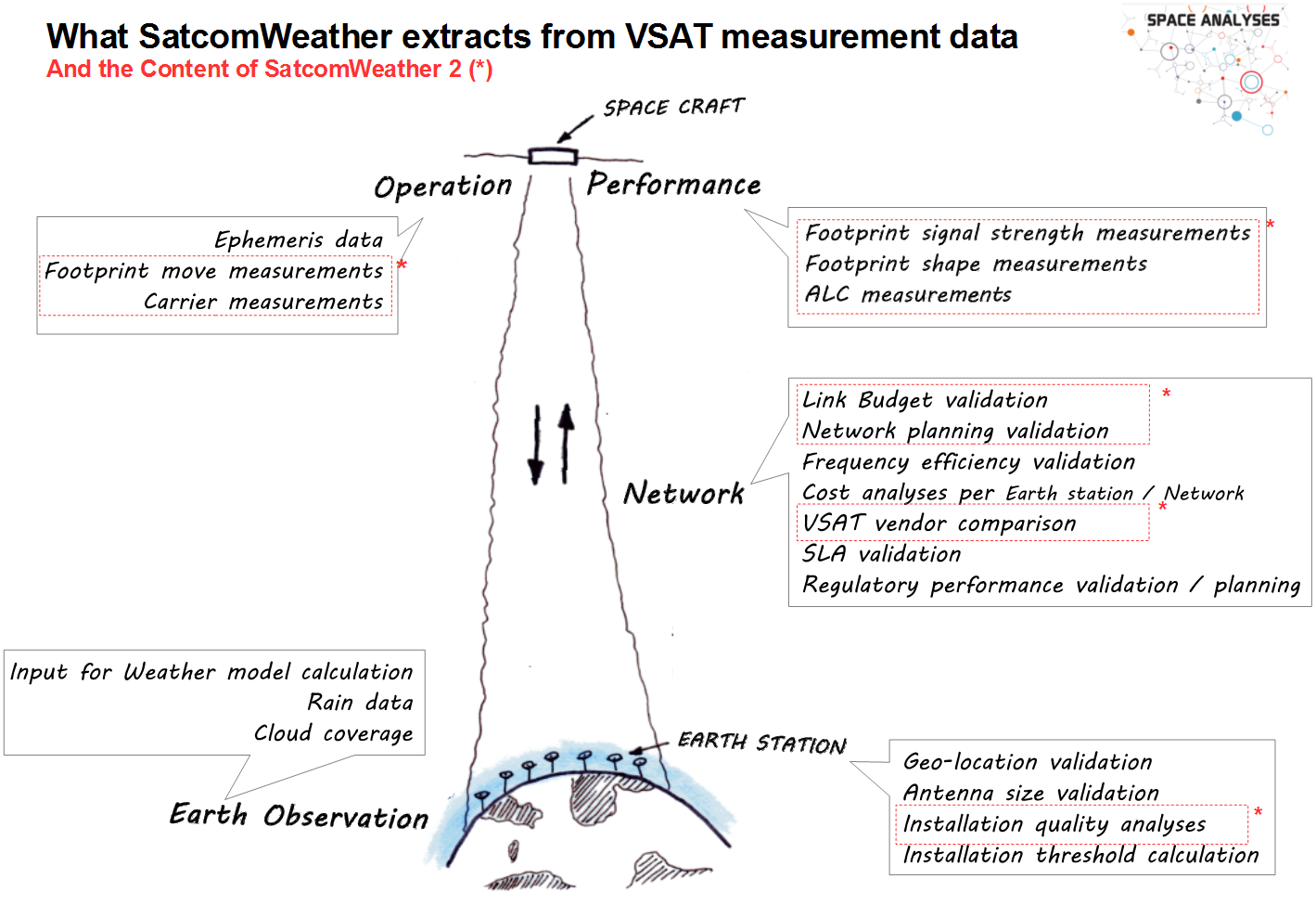
The main objectives are to develop the algorithms and infrastructure to calculate products such as
- installation quality,
- footprint move (on Earth surface), an

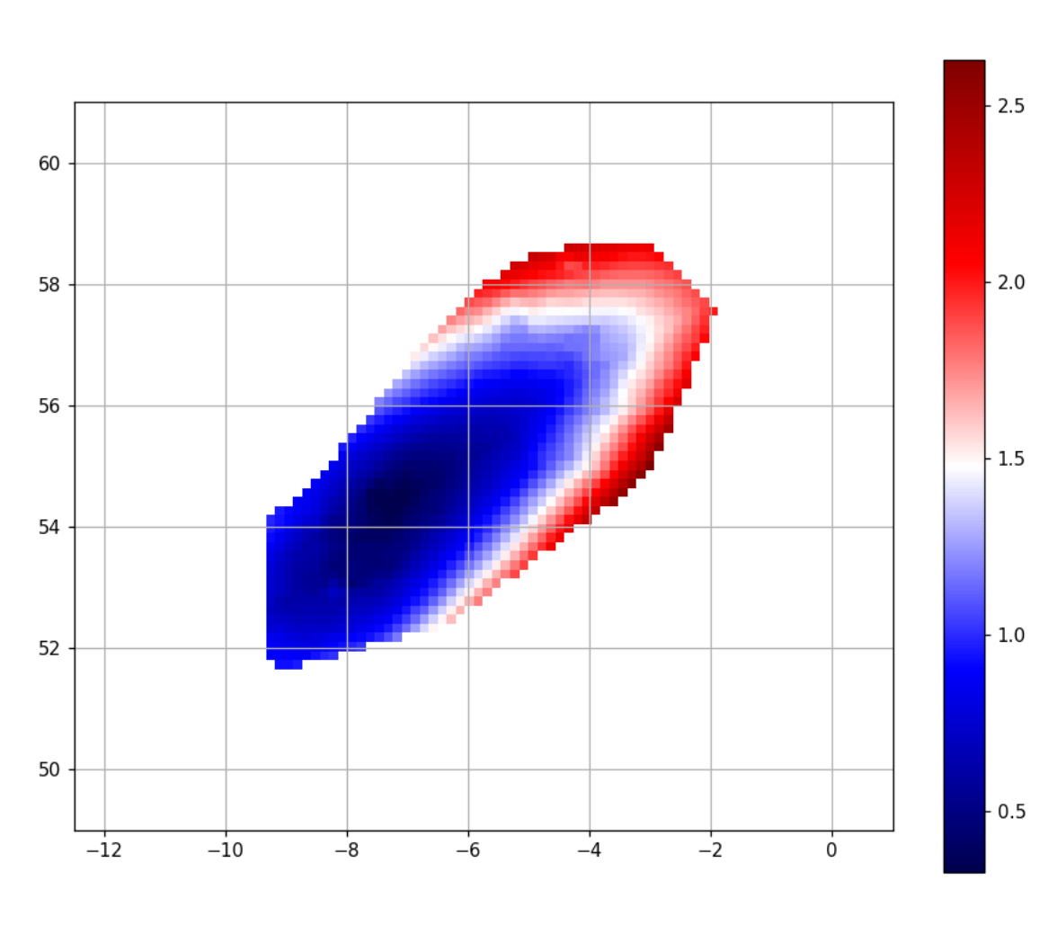
- empiric update of link budget maps (in contrast to model based link budgets) and an
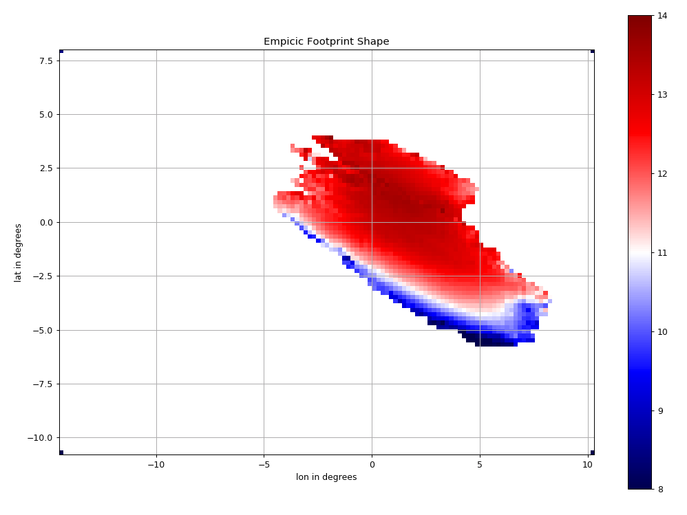
- empiric validation of the footprint form.

Side products which are developed include
- local signal level estimations,
- rain detection,
- signal level change detections and
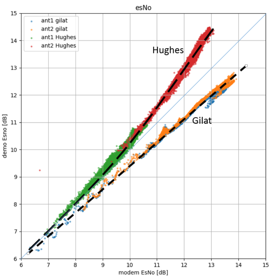
- a comparison of signal quality measurements of different VSAT systems
Benefits
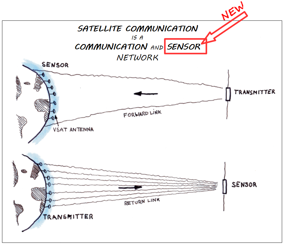
Additional Results due to Sensor Network Approach
What is old and what is new
- Footprint shape: A reliable footprint shape that will bring the satellite operator a high valuable insight of their satellite pointing in order to optimize their frequency efficiency, to reduce risks on SLA, and also to validate the space craft specification independently from the space craft prime and in operational mode
- Link Budget Input Map: An empiric measured input (as map) to the link budget calculation helps the satellite operator to validate the expected signal strength versus the model based hypothetical link budget.The picture shows the deviation of the empiric link budget to the given model link budget
- VSAT Measurement Harmonization: in the precursor project it was noted that signal quality reports from different VSAT vendors shows significant deviations (temporal resolution, signal strength, recorded parameters and attenuation). Comparability of the VSAT measurements enables payload operators to harmonize the interpretation of effects, make the effects comparable effects and can harmonize thresholds.
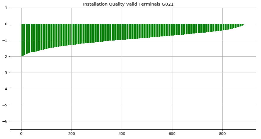
- Installation quality reporting of VSAT deployments: The determination of installation quality is a strong indication of the efficiency of the terminal and so a strong cost indication how much the ground station occupies bandwidth in relation to other stations.
Features
The planned products enable satellite operators to increase productivity of assets of Satellite communication operators by putting intelligence to VSAT measurement data.
The project will pave the way for:
- Paradigm shift in SatCom from single model planning to day-to-day empirical ‘production’ data.
- Technical & cost control and management based on recorded available data
- Operation optimisation of SatCom networks
- Comparison of empirical measurements of space craft parameters and link budget with actual models
- Increase spectral efficiency
- Comparison model of link quality measurement methods of different VSAT systems.
Challenges
Design, implement and operate the HW and SW infrastructure to enable access to the given amount of data of >20.000 stations over more than two years.
Develop, implement, test, optimize the above-mentioned products. The validation is the biggest challenge as no external validation seems possible.
System Architecture
The system architecture is distributed as shown in the picture.

Plan
De-risk project phase
- MS1 preliminary design review
- MS2 infrastructure review meeting
- MS3 final review
Product development phase
- MS4 critical design review
- MS5 Test readiness review
- MS6 Factors acceptance test (final review)
Current Status
The project is closed.

