PAGE CONTENTS
Objectives
Frequency spectrum is a scarce resource and with the increasing need for bandwidth terrestrial mobile operators recently gained access to spectrum that was historically allocated to satellite communication. Moreover, with the emergence of new satellite services, such as LEO HTS constellations on a global scale, the classical ITU spectrum allocations are implemented on a non-interference basis, which has not been the case for classical geostationary satellite communication. Therefore, a detailed knowledge of frequency use in all locations of the world, may it be frequencies used by satellites or by telecommunication network operators on ground, becomes more important w.r.t. identifying interference as well as unused spectrum.
The study assesses the following points:
- Commercial Assessment of Applications. The study addresses the commercial application / needs for spectrum monitoring from space. Different aspects are evaluated concerning these applications such as need for spectrum monitoring, need for accuracy of location for an RF source, time frame required for monitoring in general and specifically for identified sources, required recurrence of monitoring.
- Identification of User Cases. Further, during the study use cases are derived from the identified applications. The use cases deliver the input for a mission concept.
- Establish a Mission Concept. A mission concept is derived in the study and technical solutions are identified for the platform and the payload to fulfil the identified user needs. The solutions take into account the complexity of analysis to be performed in space and on ground, properly identify required trades with respect to available technology and cost.
- Technical Feasibility Assessment. Finally, the study assesses the technical feasibility of the proposed solution and initially defines a scenario to implement such a mission.
To summarize in short, the main objective of the study therefore is to identify user needs for spectrum monitoring from space and to define a commercially viable system fulfilling the identified user needs.
Challenges
Key challenges of the activity:
- Defining realistic scenarios based on inputs from target customers
- Mission and system level trade-offs without detailed scenario definition: versatility, accuracy, cost, mission scenarios
- Detailed performance simulations w.r.t. geolocation approach
- Wide range of scenarios, many transmissions have highly directive antennas
- link budget strongly varies over time
- Short durations with sufficiently high SNR
- Formation distance as compromise between geolocation techniques as well as covered scenarios
- Wide range of scenarios, many transmissions have highly directive antennas
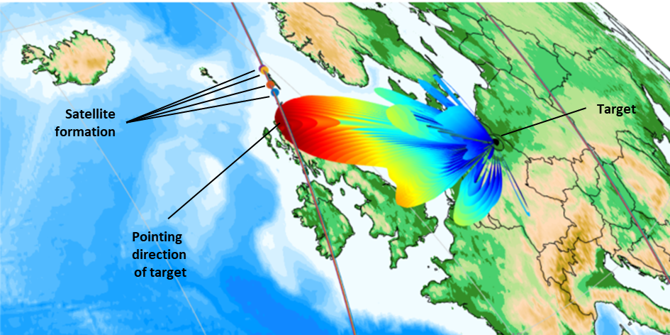
- Focus on small cost-efficient satellites like micro satellites or smaller
- Implement all desired functionalities and performance w.r.t. frequencies and geolocation accuracies
System Architecture
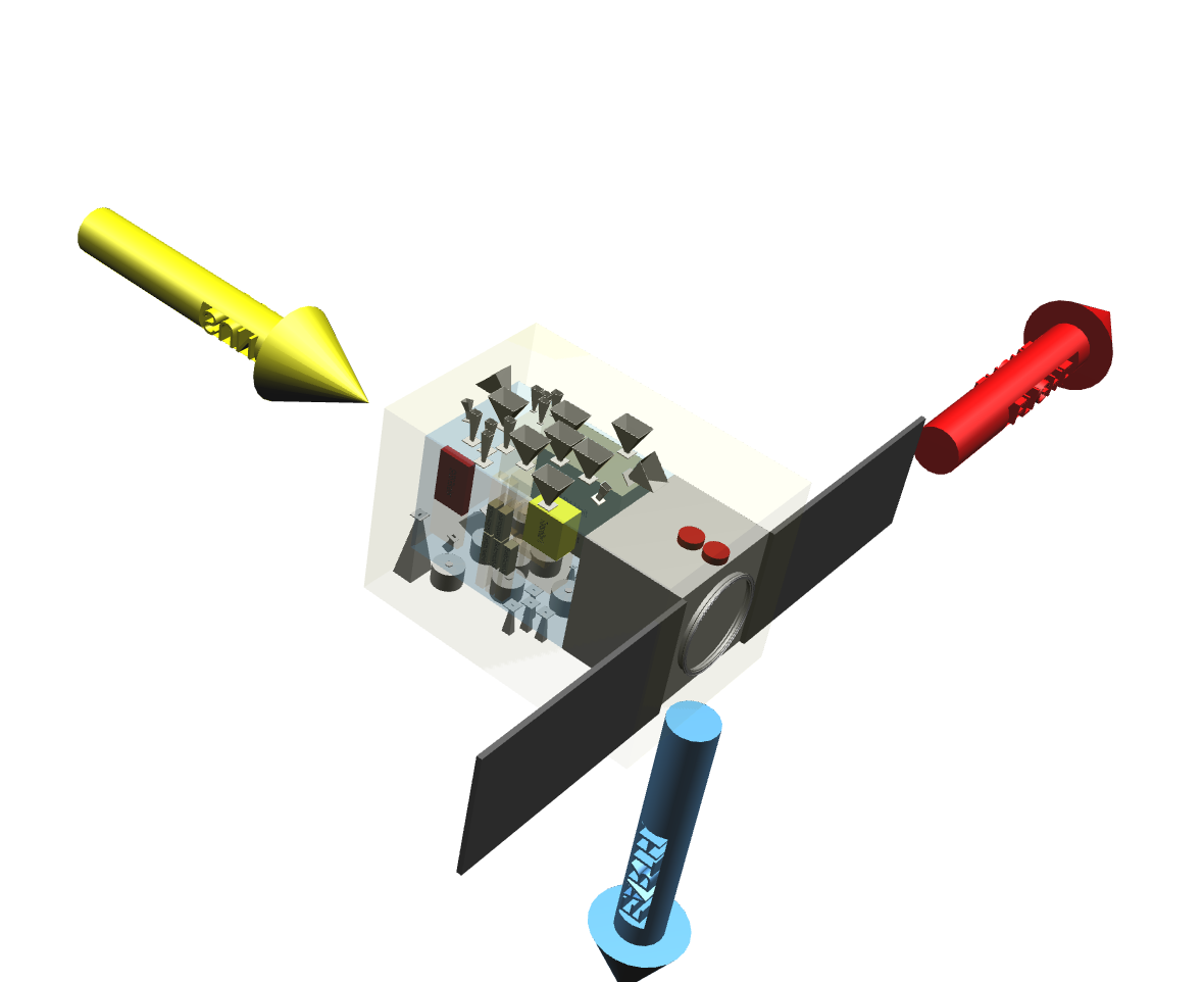
The conceptualized space system is composed of a formation of four satellites each consisting of a platform and payload module . The system is foreseen to be deployed in a near-polar SSO at ~ 600 km.
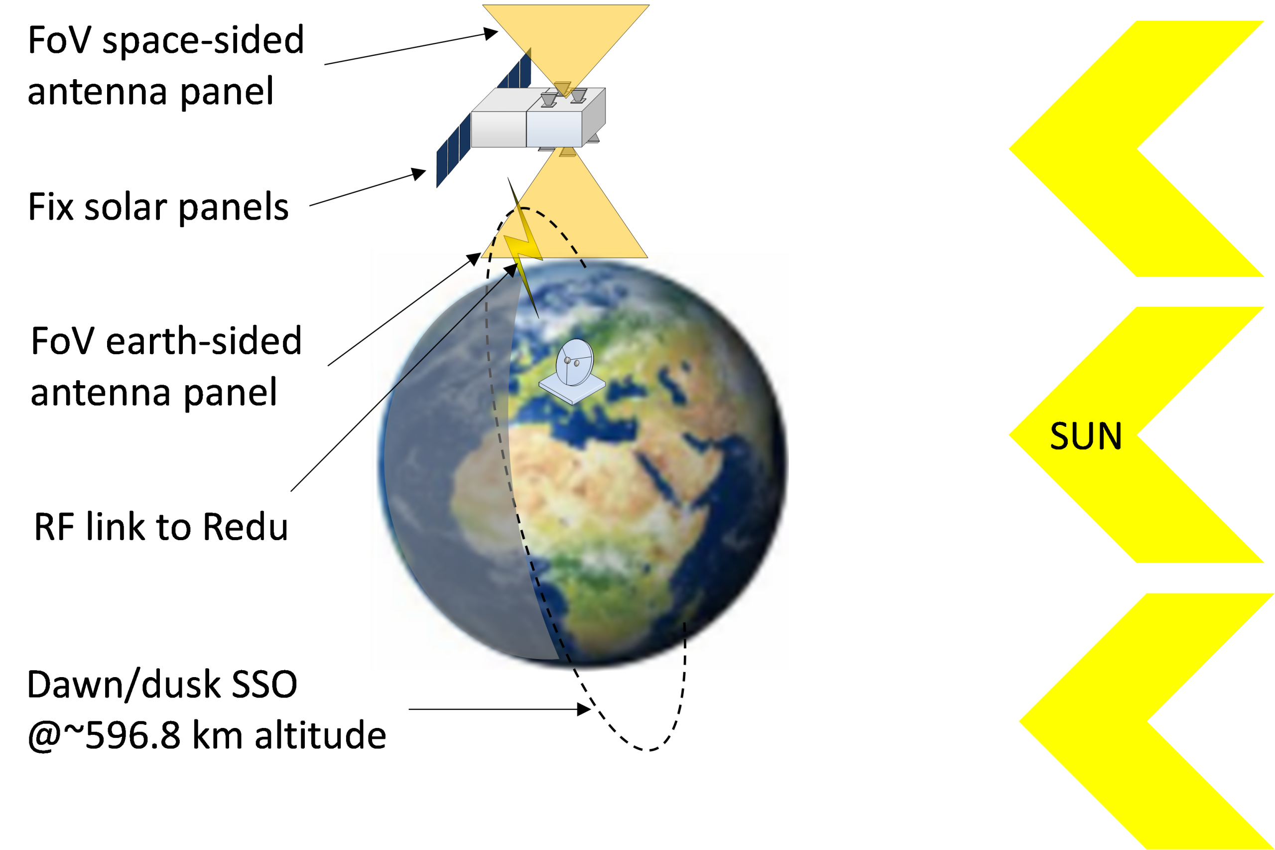
- Platform based on InnoSat from OHB Sweden
- Standard platform available for small satellite missions to reduce development and implementation schedules as well as costs
- Only minor mission-specific adaptations (e.g. EPS)
- Payload module
- New module to be developed for this mission
- COTS products fostered
- Antennas to be space-qualified
- Data storage / GNSS receiver without need for development activities
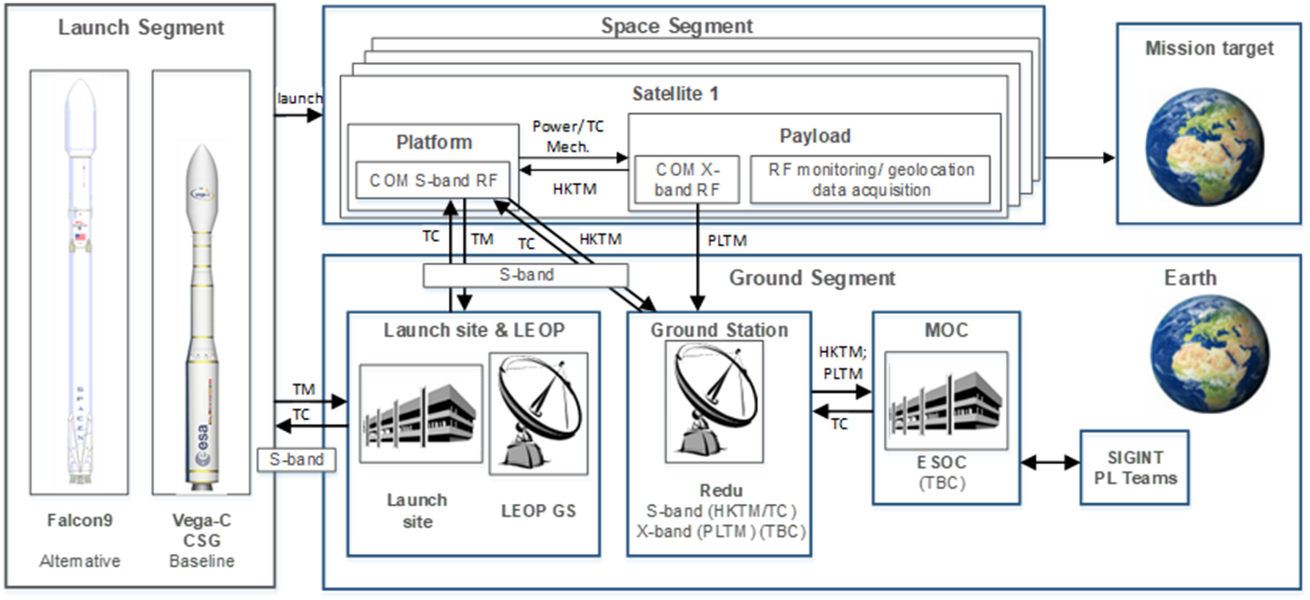
A high-level overview of the derived mission architecture is provided within the following figure.
Current Status
The study is closed and the results are available.

