-
StatusCompleted
-
Status date2025-11-13
-
Activity Code3C.025
The objective of the UAV-3S project is to produce key system tools needed for the design of UAV satellite terminals. More specifically, these system tools identify the UAV satellite terminal gain needed in the whole range of elevation and azimuth to ensure the required link availability and link performance in all flight phases.
To be more specific, the project aims to fulfil the following objectives:
- Survey the UAV market and assign candidate UAV satellite terminals to UAV platforms of different classes, based on their payload accommodation capabilities.
- Define the most promising UAV service use case and satellite system scenarios for simulative evaluations.
- Design, develop and test an end-to-end system simulator that provides performance indicators which are key for the development of UAV satellite terminals.
- Perform performance evaluation simulation campaigns for the selected scenarios, parameters and Key Performance Indicators (KPIs).
- Identify based on the mismatches, the gain required in the whole elevation and azimuth range around the UAVs to guarantee the required link performance and link availability in all flight phases.
Some key challenges detected in the project were:
- Limited availability and quality of UAV input data
- Response: Collected realistic UAV flight paths, 3D models, antenna patterns, terrain data, and channel models; pre-processed into simulator-ready formats. More real/realistic UAV traces should be obtained.
- Implementation of the dynamic functionality to the simulator
- Response: The dynamic functionality included implementation of processing the UAV trace data as well as the satellite trace which came straight from the input collection.
- Implementation of the combined antenna gain
- Response: Implementing the combined antenna gain calculations and having it fit to the overall simulator design.
The project provides multiple benefits:
- Provide a flexible software simulation capability of identification of UAV satellite terminal requirements.
- Identify the UAV satellite terminal gain needed in the whole range of elevation and azimuth to ensure the required link availability and link performance in all flight phases.
- Flexible configurations for both the satellite communication system, but especially in terms of the UAV assumptions, e.g., UAV flight paths, attitudes, operation environments, as well as antenna patterns.
- Graphical easy-to-use workflow for providing essential KPIs and demonstrations.
The UAV-3S simulator offers two specific simulation capabilities:
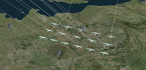
- Simulation capability 1: Stationary (but configurable) UAV location grid on targeted (satellite) coverage area. This can be considered as a larger scale and (more) static simulation scenario, where the terminals are stationary, but the satellite(s) may move along the orbit.

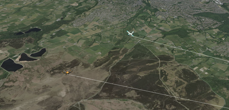
- Simulation capability 2: Dynamicity of individual UAV flights over certain predefined flight paths. This includes the flight paths, dynamic attitude, ground morphology and related channel models and blockages. Note, that here both the UAVs as well as satellites may move, and in fact, also one-to-many simultaneous UAVs need to be able to be simulated.

The UAV-3S simulator is planned to be highly configurable, e.g., in terms of:
- Geostationary orbit (GSO) and Non-GSO satellites system configurations, e.g., number of satellites, locations, and altitudes.
- Link budget parameter configurations, e.g., satellite access node antenna/beam configurations, transmission power levels, bandwidths.
- Frequency bands, from L- up to Q/V-bands.
- UAV flight paths and operation environments.
- Terminal antenna patterns/models, mounting options at the UAV.
- Air interface (waveform) configurations, e.g., 5G NR-NTN and Digital Video Broadcasting (DVB).
The UAV-3S has a graphical user interface, which enables the simulator configurations, simulation execution, results plotting and visualisation/demonstrations.
The developed UAV-3S simulator is based on an existing set of software tools, which is further enhanced during the project towards the UAV use cases. The UAV-3S functionality is based on three main components:
- Input data acquired from UAV operators (e.g., UAV position and attitude traces) and/or generated with other software tools, such as MATLAB’s UAV toolbox (ground morphology and channel models).
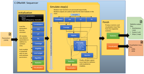
- C-DReAM capacity/link budget level system simulator for modelling the (various type of) satcom link budget, availability, error, and throughput performance.
- Magister SimLab as a Graphical User Interface (GUI) for simulation configuration, execution, results processing, and demonstration.

The project started in October 2023 and with 21 months duration is scheduled to end in June 2025. The work has been divided into following work packages:
- WP1.0: UAV Analysis
- WP2.0: Scenarios and System Requirements Definition
- WP3.0: Simulator Requirements and Design
- WP4.0: Simulator Development
- WP5.0: Simulator Testing and Performance Evaluation
- WP6.0: Scenario Solutions
- WP7.0: Project Management
- Project started officially on 4 October 2023 and an official kick-off meeting was held on 24 October 2023.
- UAV Analysis Review (UAR) was accepted on 4 March 2024.
- Scenarios and Requirements Review (SRR) was accepted on 25 May 2024.
- Scenarios and Requirements Review (SRR) was accepted on 25 May 2024.
- Software Design Review (SWDR) was accepted on 17 December 2024.
- Testing Readiness Review (TRR) accepted on 7 May 2025.
- Testing Acceptance Review (TAR) accepted on 11 September 2025.
- Final Review (FR) accepted on 5 November 2025, and the project is completed.


